Research
Growth modelling, management for wood quality and carbon sequestration
The quality of European beech forest can be improved by selecting and supporting of those trees, which will produce valuable timber. An important tool for controlling quality development is the growing space, which influences natural pruning as well as diameter growth of the trees. The data base for growth modelling are long-term permanent plots in which trees have been treated according to quite different management concepts.
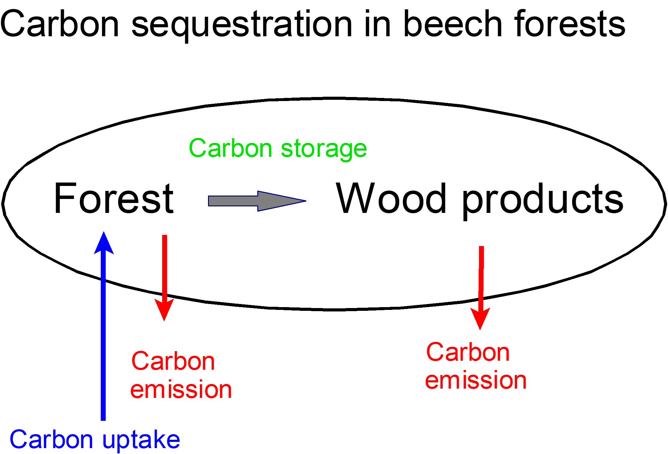
Forests as carbon sinks can mitigate climate change. In this project carbon uptake and storage in the wood in the forests and the storage in wood products is analyzed. In order to increase carbon uptake the length of the production cycle is determined in such a way, that maximum average annual uptake is reached (blue arrows). In addition, carbon should be stored as long as possible in the forest and the wood products before the carbon is released to the atmosphere (red arrows). Therefore, high growing stock in the forest and a valuable wood products should be achieved, in order to store carbon for a long time.
Terrestrial Laser Scans
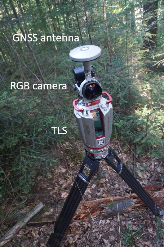
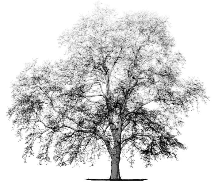
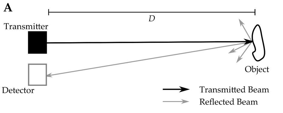
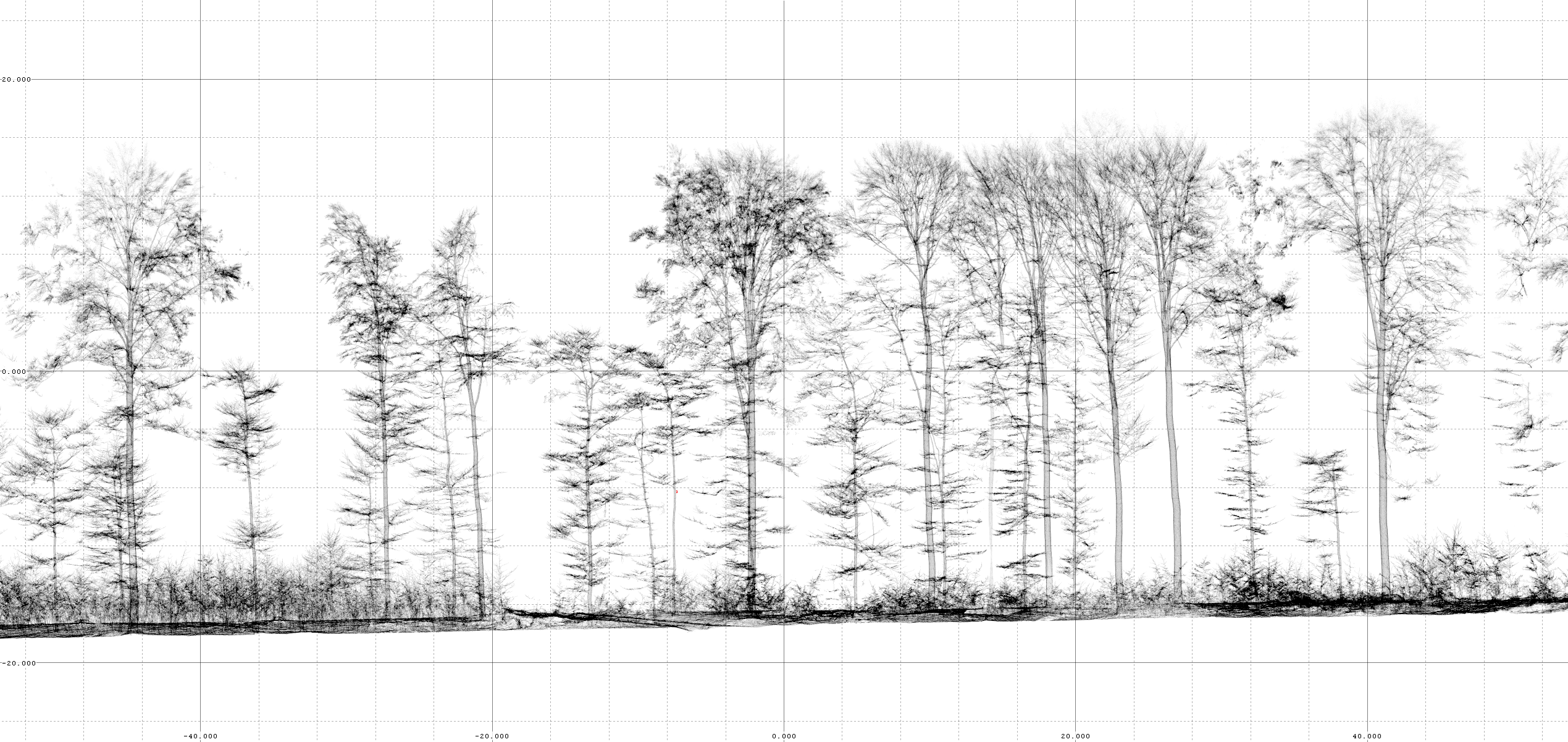
Terrestrial Laser Scanning (TLS) is a method of creating a three-dimensional representation of the environment by means of multiple laser distance measurements accurate to the millimeter. Modern scanners record several million points per minute to create a detailed digital copy of their surroundings. By scanning from multiple angles, even previously occluded areas can be captured. With additional sensors such as cameras and GPS devices, world coordinates and colors can also be assigned to the points measured in this way. We create a highly accurate image of the stand from about 150 scan positions/ha, from which a great deal of relevant information can then be derived. Such a scan can already be implemented in the field in about three hours. The usual process from raw data to usable information includes the following steps:
- Automatic filtering of individual scatter points, very dark and very imprecise points.
- Automatic merging of the single scans (registration).
- Modelling of the ground level for each point in the area.
- Detection of trunk base coordinates.
- Extraction of trunks and coarse branches.
- Segmentation of individual trees.
- Determination of inventory parameters such as breast height diameter, tree height, crown size etc.
- Determination of other characteristics such as biomass.
Scanning of full stands
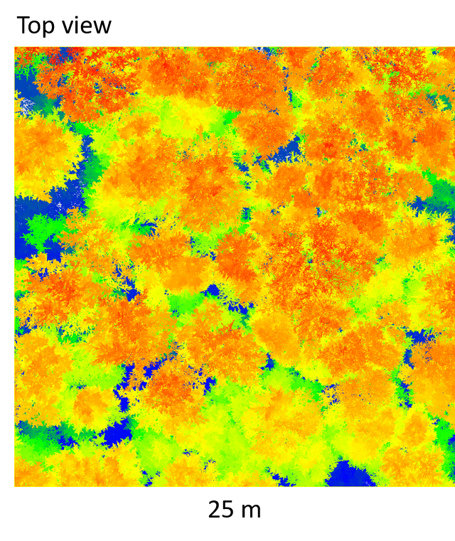
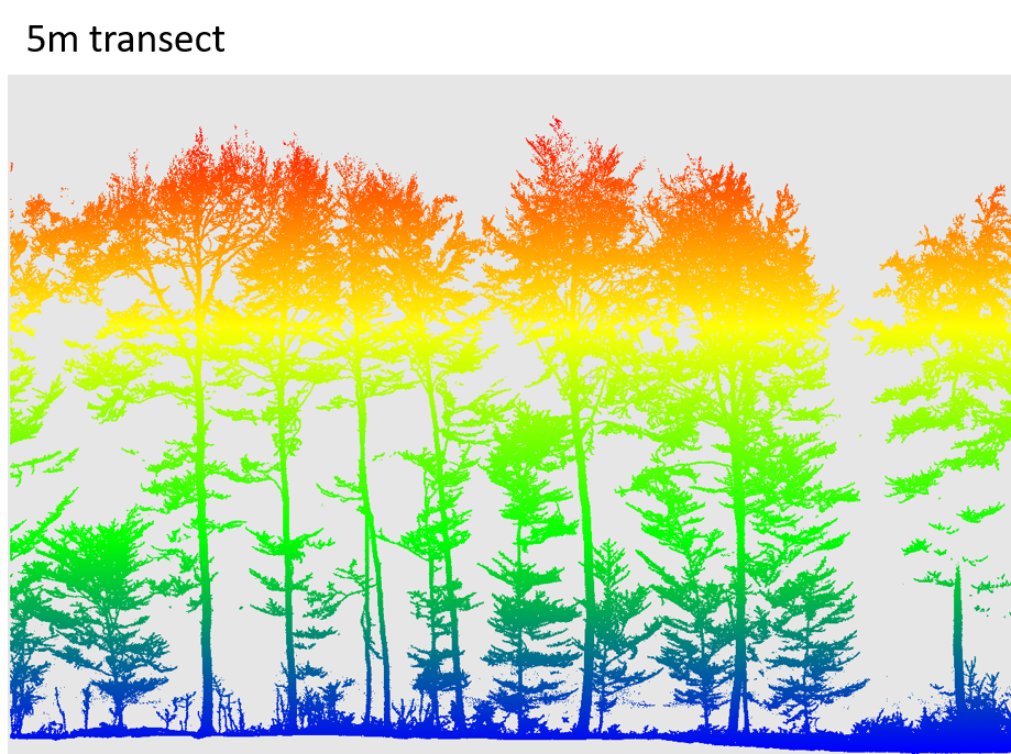
The data sets obtained provide a much higher level of detail with less field work than a conventional forest inventory. In addition, many attributes that can only be determined very imprecisely using conventional inventory methods can be derived much more accurately in this way. However, there are still considerable deficits in the development of methods to derive all desired parameters completely automatically. Individual parameters such as tree species, which can be easily determined visually in the field, can currently identified from TLS data automatically with insufficient accuracy.
For the derivation of wood quality characteristics from TLS data via the detection of small-scale stem structures such as angular scars, spiral grain, wavy grain, woodpecker cavities, cracks and the like, there is still a considerable need for research.
Single tree delineation
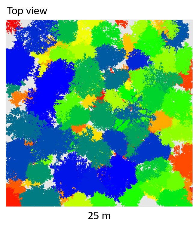
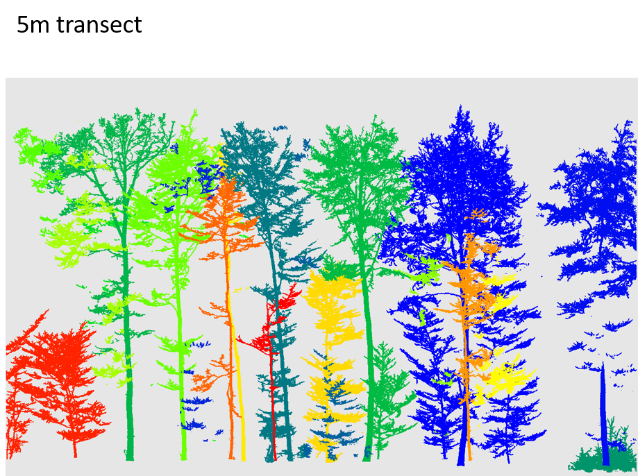
Our vision is that in the future, handheld laser scanning sensors will be used to automatically derive information that will enable the selection and promotion of particularly high-yielding trees. Digitization in the forest not only has the potential to make forestry processes less labor-intensive, but also to promote optimal utilization of biomass as high-quality wood products. Less waste and firewood significantly improve the climate balance in forest utilization here.
